KETTLE VALLEY RAILWAY IN NARAMATA
The Kettle Valley Railway was is one of the most remarkable sections of railway ever built in North America. It stretched from Mid-Way to Hope, Via Penticton. The route was carved out of the most rugged terrain. Although the Trains have stopped running, you can still explore the old routes, and see the stunning views for your self. The rails have now been lifted and turned into a linear park with flat trails suitable for hiking and biking.
How to access the KVR trail from Naramata
From Naramata there are two options for hiking trail routes. The first option is to head south on the KVR, towards Penticton.
The second option is to go North towards the Little Tunnel, and connection with the “Trans Canada Trail”.
Naramata is just 20 minutes north of Penticton, and is an easy drive, past vineyards and scenic views.
Once you are in Naramata, you are looking for the Smethurst Road Parking Lot.
How to find the start of the Little Tunnel Trail
Directions: Turn onto Smethurst Rd. and keep going until you reach the car park.
It is a little difficult to find the first time, so here are some more detailed driving instructions:
Drive North along Naramata Road. The turn you want is just after the main turn off for Naramata centre (look out for Robinson Road, where the road forks).
Soon after you will see the turn off for “Smethhurst Road” on your right. It is small and easy to miss, so keep an eye out.
Keep following Smethurst all the way up, past houses and the small “Bench Mark” bed and breakfast. Eventually you will arrive at the parking area. Here you will find washrooms, and signs for the start of the Kettle Valley Railway Trail!
Map of the walking routes in courtesy of the Visitor Information centre, at 553 Vees Street Penticton. They will be happy to provide more information about hiking and biking options in the local area.
Finding the Naramata Kettle Valley Rail Trail Access on Google Maps.
This map shows the route from Penticton to Smethurst Road (in Naramata, BC). To view the map in more detail, or text a copy to your phone click the “more options” link in the top left corner.
Walking the “Little Tunnel” lookout over Naramata
After arriving in the Smethurst Parking Lot, you can reach the little tunnel on foot, or by cycling.
It is a 4.4 km walk from here to the tunnel, and the path is straight and even. The walk to the tunnel takes about an hour and 30 minutes (if you don’t take the detour to see the rock ovens). The return walk seems slightly faster, as the gradient is a very slightly down hill.
For more details have a look below at the printable “Penticton to Chute Lake” map, which shows the directions and road turn off for reaching the little tunnel.
Remember to bring lots of water if you are walking the trail in the summer months.
View of Okanagan Lake from the Little Tunnel
Printable Maps and Routes of the Kettle Valley Railway in the Okanagan
Courtesy of Penticton and Wine Country Visitor Centre
KVR Trail from Penticton to Chute Lake, showing the Adra Tunnel bypass Trail, the Water tower and house, rock overs 4 and 5, Glenfir Loop and wood wacker trail.
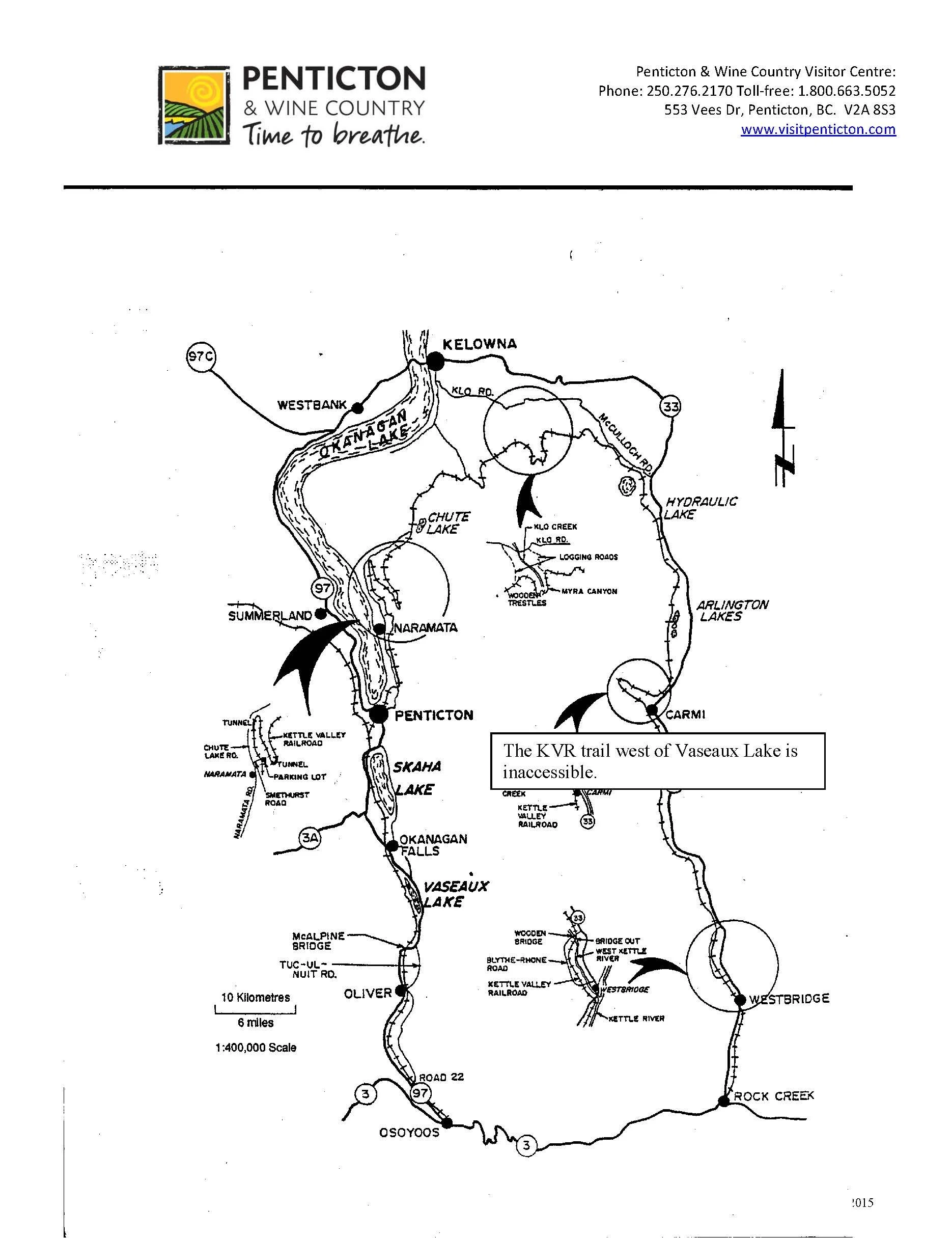
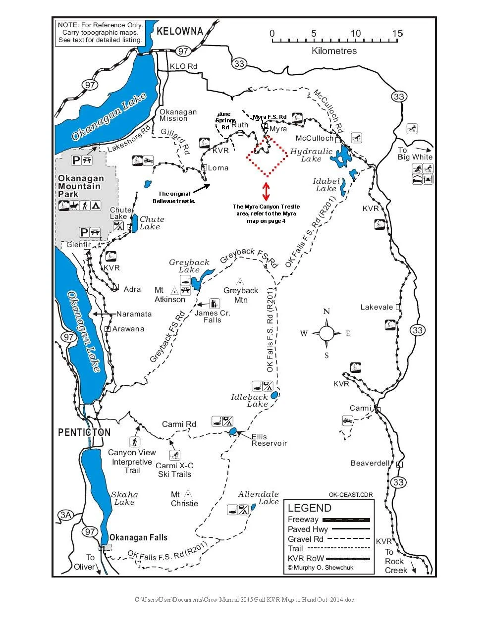
Map showing the Kettle Valley Rail Trail (KVR) from Osooyos through Vaseux Lake, Okanagan Falls, Penticton, Naramata and Kelowna too
More information about hiking on the Kettle Valley Railway
KVR Trail from Penticton to Myra Canyon Trestles
KVR Trail from Naramata to Myra Canyon Trestles (Kelowna)
Kettle Valley Railway Trail – Princeton to Penticton
Printable Maps and Routes of the Kettle Valley Railway in the Okanagan
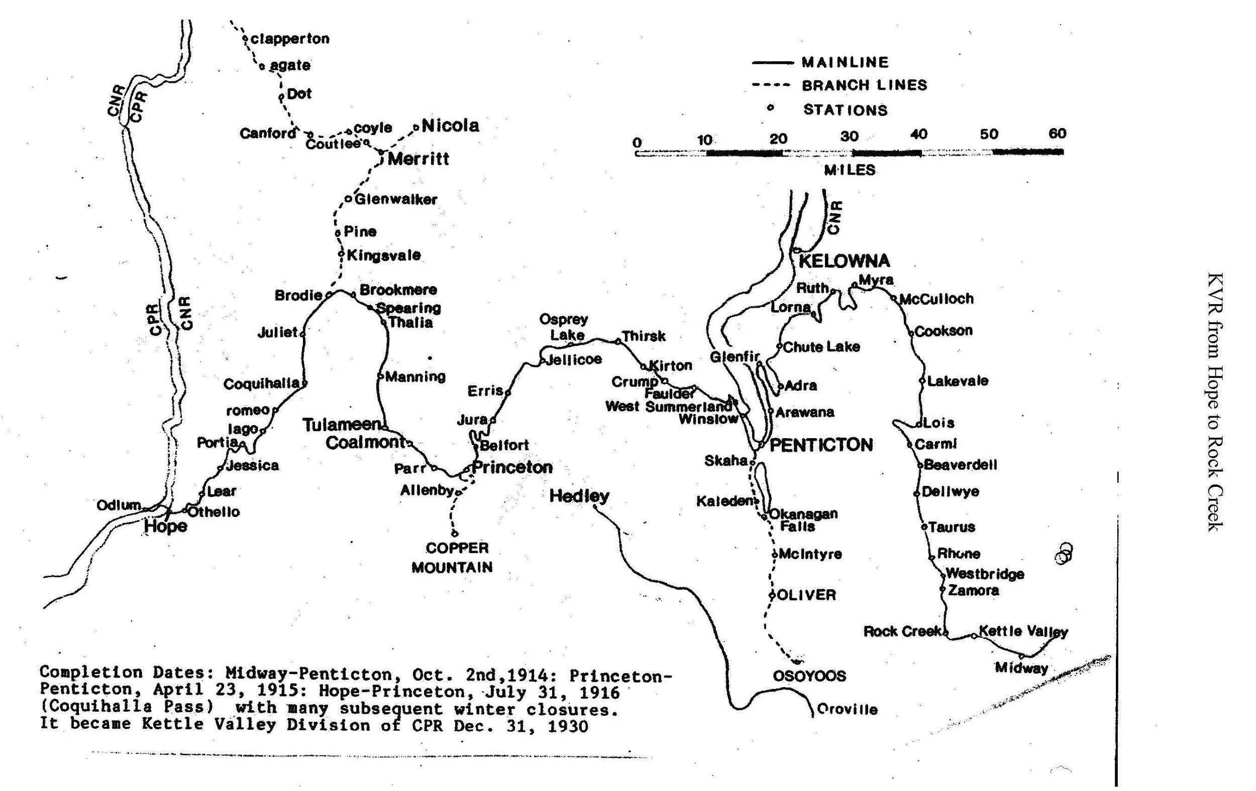
Full Historical Route of the Kettle Valley Railway – from Midway to Hope, Via Penticton.
Printable map of the 8.5km section of the Kettle Valley Railway (Carmi Subdivision) containing 18 trestles and two tunnels
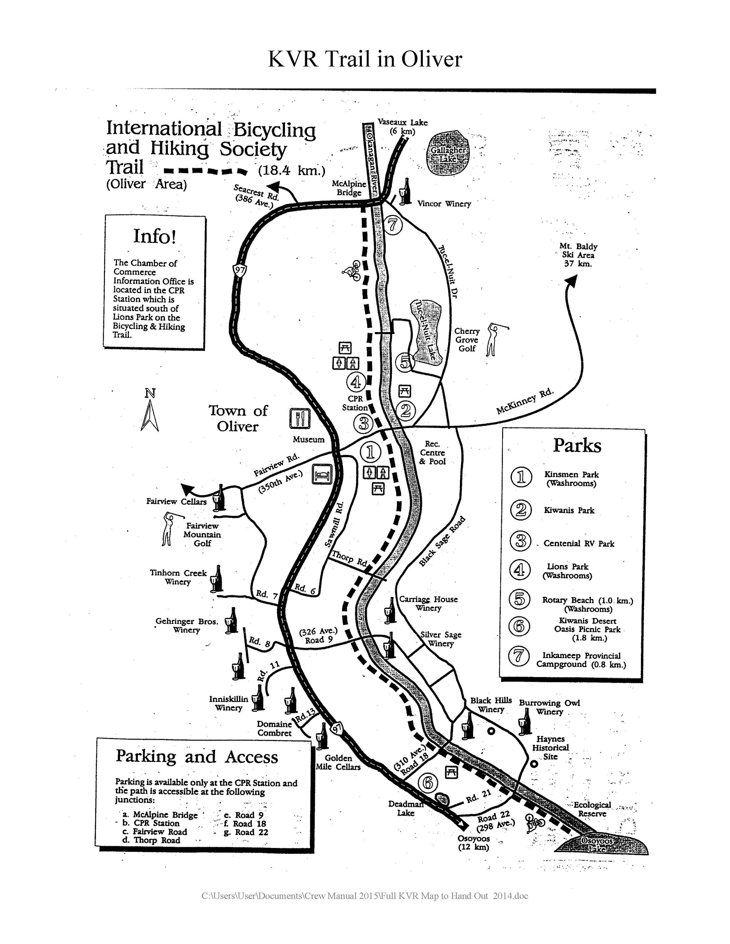
Printable map of the Kettle Valley Rail Trail in Oliver, BC
RELATED ARTICLES